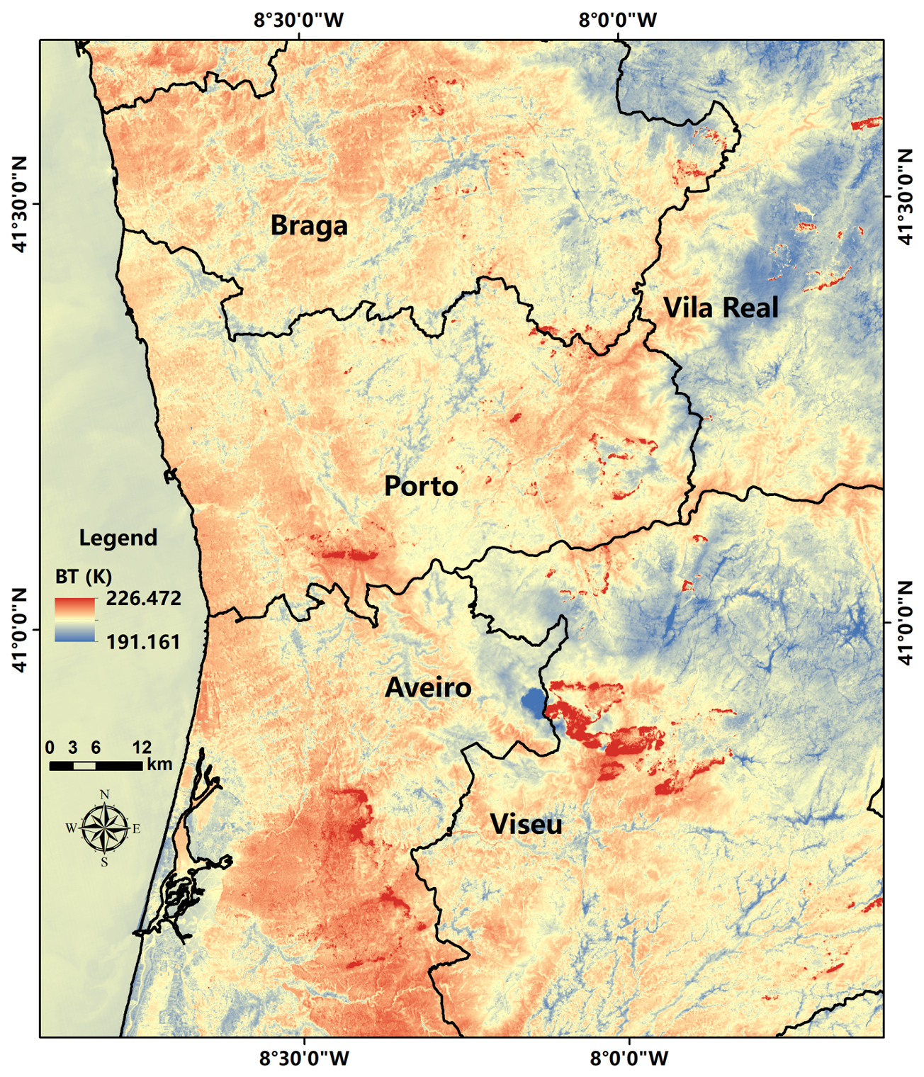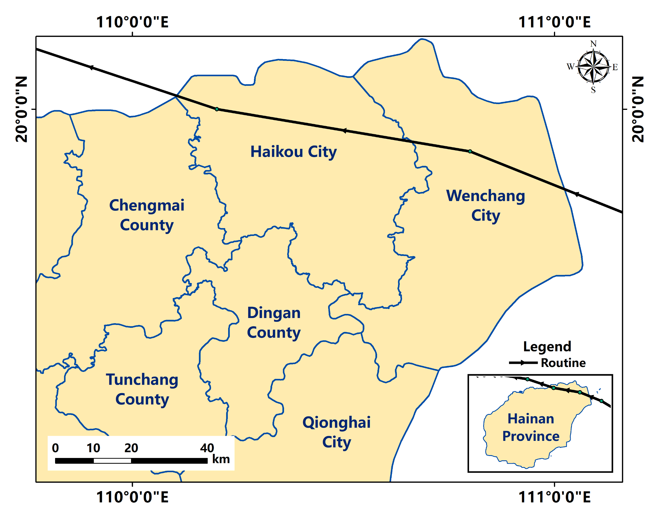
Asia’s strongest storm this year, Super Typhoon Yagi, landed in Hainan Province, China at Wenchang City (east of Haikou City) on 6 Sep., 2024, at 8:20 (UTC), bringing violent gales and heavy rain that triggered widespread power outages, paralysing the tourist island province known as “China’s Hawaii”.
The International Research Center of Big Data for Sustainable Development Goals (CBAS) conducted emergency mapping of typhoon affected areas.
The SDGSAT-1 satellite was scheduled to conduct overpasses to capture Glimmer Imager (GLI) data of Hainan Province (especially Haikou City and Wenchang City) on 11 September, 2024, and 16 September, 2024, respectively.
IRDR and CBAS will continue the monitoring of the damage.